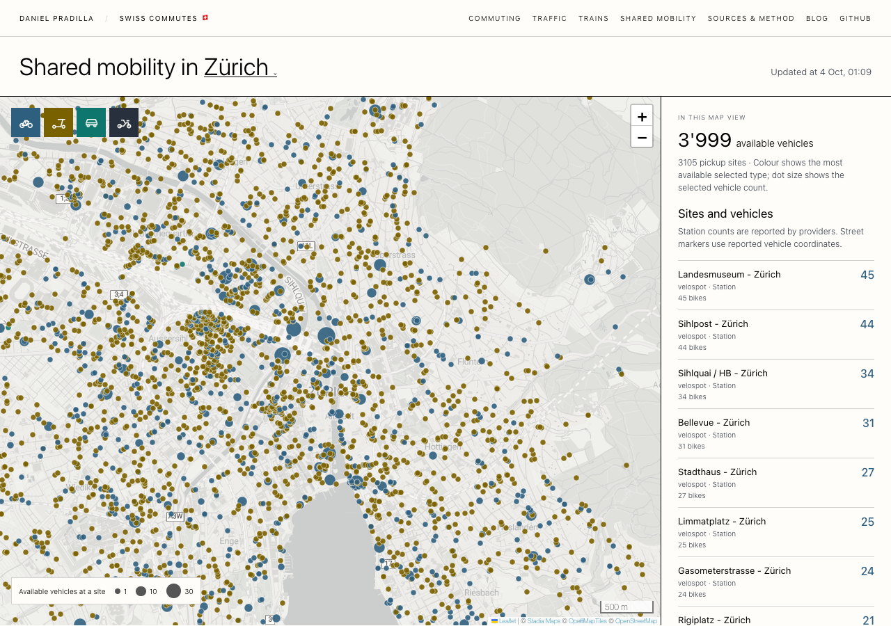
Try the Zürich shared mobility map here
This is the third live view I added next to the commuter map. It shows the shared bikes, e-scooters, cars and mopeds that are available to rent right now in the same 16 cities.
Each provider has its own app and only shows its own vehicles. Here they are all on one map: the Velospot bike stations, Lime, Dott and Voi scooters, cargo bikes from Carvelo2go, and car sharing from providers such as Edrive and Quickrent, among others. Blue dots are bikes, ochre dots scooters, teal dots cars and dark dots mopeds. A bigger dot means more vehicles at that spot.
The map opens zoomed in on the city centre, and in Zürich that view is mostly scooters. At 01:09 on Sunday 4 October it held 3,999 available vehicles at 3,105 different pickup sites, and most of the dots were ochre, spread over almost every street. The bike stations stand out as larger blue circles among them: 45 bikes at the Landesmuseum, 44 at Sihlpost, 34 at Sihlquai next to the main station. You can see the two ways these services work side by side, fixed stations in one case and vehicles left wherever the last rider stopped in the other.
The four buttons in the top corner switch bikes, scooters, cars and mopeds on and off. The list on the right follows the map: it counts only what is inside the current view, puts named stations first, and pans to a site when you click it. Hovering a dot shows the site, the vehicle types, the count and the provider.
Data Sources & Methodology
The data come from sharedmobility.ch, run by the Swiss Federal Office of Energy (SFOE/BFE), which collects the GBFS feeds of participating providers. The page reads the combined GBFS 2.0 files for vehicle types, free-floating vehicles, station information and station status. The combined station status gives one number per station, which cannot separate bikes, scooters and cars, so for providers with several kinds of vehicle at their stations I also read their own GBFS 2.3 station status, which breaks the count down by type.
Station reports older than ten minutes do not count. Free-floating vehicles are placed at the coordinates the provider reports, and only vehicles from the same provider at exactly the same point share a marker. A vehicle parked exactly at a known station takes that station's name and is not counted twice. Reserved and disabled vehicles and closed stations are left out.
The source server sends a duplicated CORS header, so browsers cannot read it directly. A small PHP script on my server passes the four files through and keeps each one for at least a minute, and the page refreshes once a minute while it is open. The time above the map is the oldest update time among the four files.
The counts are absolute numbers, not a share of station capacity. Availability can change after publication (someone may take the scooter before you get there), and not every provider in Switzerland takes part in sharedmobility.ch. The total covers the current map view, not the administrative city.
